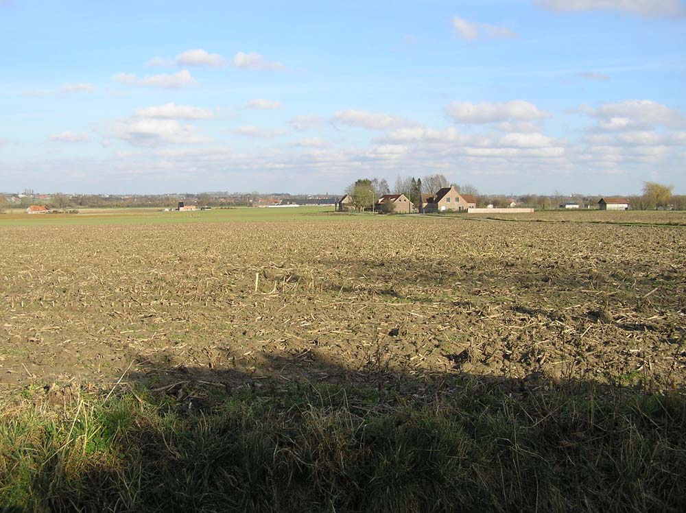
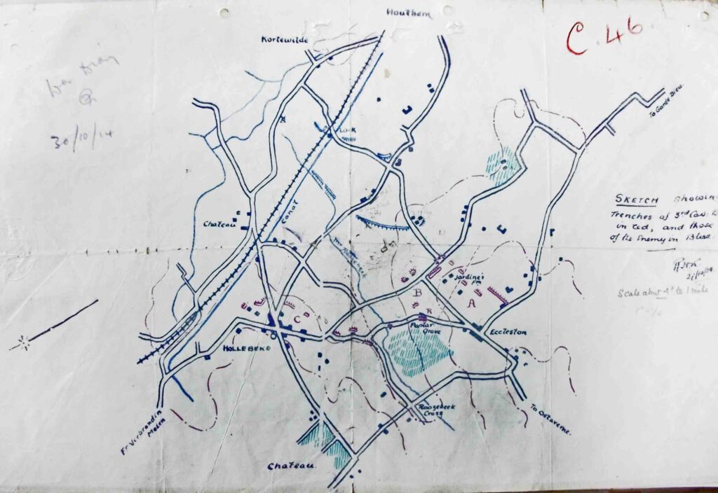
British cavalry squadrons were left to organise a defence of the long flank of open farmland south of Ypres as battle raged in front of Geluveld in late October 1914. They could not make a continuous defence line, so they concentrated in small entrenched positions where they found high points in the landscape. On the map below, you can see the chosen positions in front of Hollebeke.
National Records Office WO95/3924

The troopers reinforced point C in front of the village, and points A and B on the end of a small ridge some kilometre to the south next to the hamlet of Groenelinde , now known as De Linde (‘Eccleston’ on the map). The two strongpoints were in visual contact with each other, both looking towards the Germans across ground that gently sloped towards the canal. The second photograph is taken from point B, looking towards the canal. The hand drawn map shows that the Germans had dug in close to them, by the houses seen in the middle distance. A week before the fighting started the Hussar and Lancer squadrons were reinforced by a battalion of the 129th Duke of Connaught’s Own Baluchis, about 750 strong.
What should also be noted is the orientation of the defensive trench at point A, which faces almost due south, showing an awareness that should the Germans try instead to push past the isolated strongpoint, they might expect to fight on all flanks.
At 8 am on 30th October, two Bavarian regiments attacked, one straight along the canal engaging the Baluchi company at point C, the second directly assaulting ‘Jardine’s Farm’. The German units outnumbered the defenders by about six or ten to one, but the Germans besieged these strongpoints rather than using a covering force to engage them while pushing their extra numbers through the gaps north and south of A and B. Both clusters of cavalry troopers and Indian (Pakistani) companies held out for some five hours, taking all impetus out of the planned German attack that had much more ambitious aims: the capture of the canal bend and the high country behind. The same failure occurred on the other side of the canal in the grounds of the Hollebeke Chateau. (See Palingbeek 1915 p.2 – 25)
